
Continuing from last week’s theme of the construction of Dagenham, we move to the area around Dagenham parish church and see how it changes over a period of ten years.
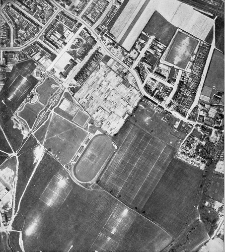
This first image shows the Leys Field and Church Elm Lane as they were c.1950. Leys in an old name for this area, dated to at least the mid 1600s from archive documents.
Snaking down the photograph to the right of the church is the Wantz stream, not culverted until later in the 1960s and at this point still prone to summer flooding. In the early 1950s there were plans to develop the Leys field into another large park similar to Central Park or Parsloes.
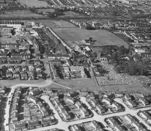
Just ten years later (c.1960) and the need for housing has lead to development of the portion of Leys field close to the church. The ambitious park plans of the 1950s have found fruit in the form of Old Dagenham park, constructed from the remainder of the Leys, and just outside the field of view of the second photograph.
The Leys field…I think this picture was pre war (pre 39) as the open air pool was opened in july 1939. It should be at the middle of the bottom picture. I put this picture as early 30’s.
MarK
I spent more than 10 years as a child and teenager in one of the “new” houses on the Leys/Rookery Farm estate in that picture. My understanding is that the estate was built in 1947 (and the houses supposedly had a 15-year life expectancy! Sure, they’ve had much renovation, on numerous occasions since, but they are still basically in good nick – much more so than some of the newer estates built, and in some cases demolished, since).
So I also suspect that the earlier photo is somewhat earlier than 1950. Earlier than 1947, too.